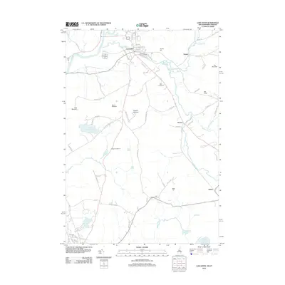
2012 Map of Lancaster
USGS Topo · Published 2012About this map
The Israel River winds through this northern New Hampshire landscape, passing through the primary settlement of Lancaster before its confluence with the Connecticut River. This 2012 survey captures the village's historic layout, including the Mechanic Street Bridge and several burial sites like Clark Cem. The area is defined by a series of prominent peaks and ridges, such as Mount Pleasant and Prospect Mountain, which overlook the surrounding valley. Local transportation and recreation are well-documented, with routes like Weeks State Park Rd providing access to the higher elevations, while Israel River Campground and Rogers Campground suggest the region's modern appeal for visitors. Smaller outlying communities like Grange, Riverton, and Baileys are also noted, showing the persistence of rural settlements established along the river and its many tributaries, including Otter Brook and Stalbird Brook.
Find a feature on this map
87 named features on this map. Tap any name to fly to it.
Don’t see what you’re looking for? This feature index may not catch every label — zoom into the map to look around manually.
Map Details
Editions of this 2012 Lancaster Map
This is the sole edition of this map. No revisions or reprints were ever made.
Other maps of this area

1893 · Mt. Washington
USGS Topo · 1:62,500

1896 · Mt. Washington
USGS Topo · 1:62,500

1900 · Whitefield
USGS Topo · 1:62,500

1920 · Guildhall
USGS Topo · 1:62,500

1930 · Percy
USGS Topo · 1:62,500

1931 · Guildhall
USGS Topo · 1:48,000

1933 · Guildhall
USGS Topo · 1:48,000

1934 · Percy
USGS Topo · 1:62,500

1935 · Whitefield
USGS Topo · 1:48,000

1935 · Mt. Washington
USGS Topo · 1:62,500