Loading...
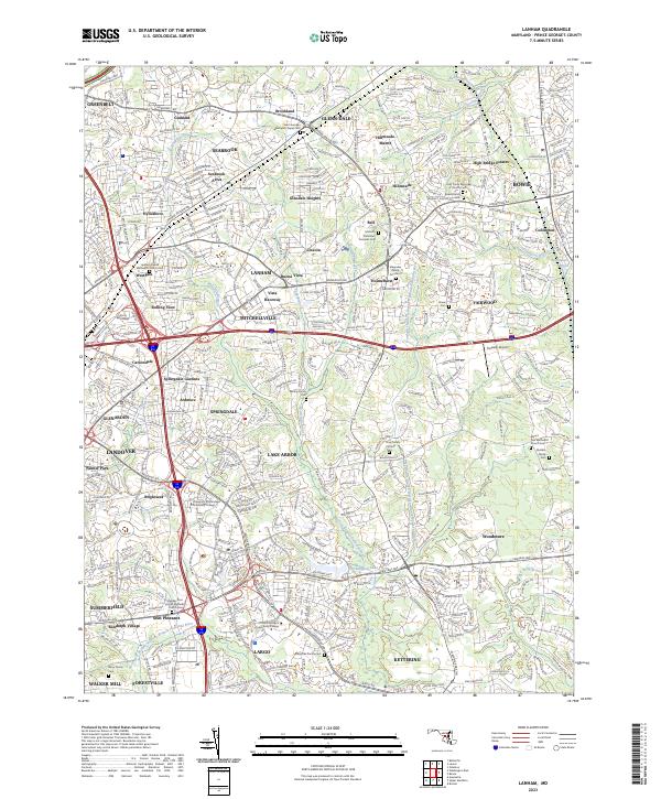
Loading map...2023 Map of Lanham
USGS Topo · Published 2023About this map
Prince George's County displays a dense suburban landscape where old family estates and churchyards meet modern institutional growth. The Northeast Branch Western Branch Patuxent River and its tributaries, such as the Collington Branch, wind through established neighborhoods like Glenn Dale, Lanham, and Bowie. Family history is deeply rooted in the soil here, evidenced by numerous private burial grounds including the Bowie Family Cem and the Marietta Plantation Grounds Cem.
Find a feature on this map
80 named features on this map. Tap any name to fly to it.
Don’t see what you’re looking for? This feature index may not catch every label — zoom into the map to look around manually.
Map Details
Date Portrayed2023
Date Published2023
PublisherU.S. Geological Survey
Map TypeTopographic
Scale1:24000
Physical Dimensions24 x 29 inches
Editions of this 2023 Lanham Map
This is the sole edition of this map. No revisions or reprints were ever made.
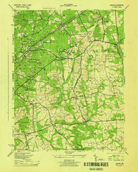
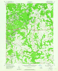
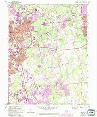
Historical Maps of Tyrol Estates Through Time
4 maps found
Featured Locations
Source Details
SourceU.S. Geological Survey
CopyrightPublic Domain