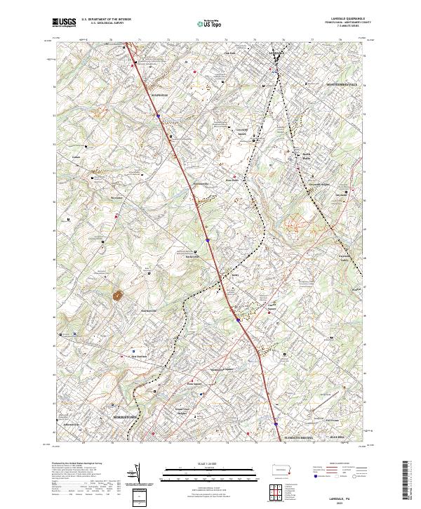
2023 Map of Lansdale
USGS Topo · Published 2023About this map
Montgomery County's rolling landscapes come into focus through this 2023 survey of Lansdale and the surrounding townships. The area is characterized by a dense network of historical religious and burial sites that reflect centuries of local settlement, including the Gwynedd Friends Meeting House Cem and the Towamencin-Mennonite Cem. Many of these features, like the Wentz United Church of Christ Cem, are tucked away along older thoroughfares such as Sumneytown Pike and Forty Foot Rd.
Find a feature on this map
84 named features on this map. Tap any name to fly to it.
Don’t see what you’re looking for? This feature index may not catch every label — zoom into the map to look around manually.
Map Details
Editions of this 2023 Lansdale Map
This is the sole edition of this map. No revisions or reprints were ever made.
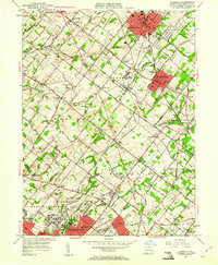
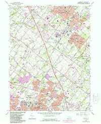
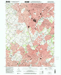
Historical Maps of Acorn Through Time
4 maps found