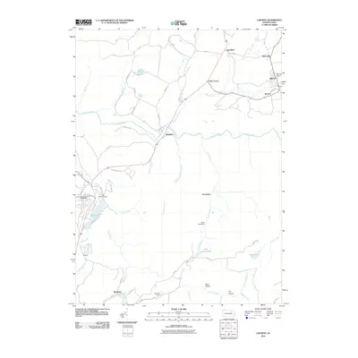
2010 Map of Laporte
USGS Topo · Published 2010About this map
Laporte and the surrounding Sullivan County highlands are defined by a network of creeks and isolated mountain settlements. The landscape is dominated by the westward-flowing Loyalsock Creek, which is fed by numerous tributaries including Birch Creek and Dutchman Run, the latter featuring Dutchman Falls near Ringdale. Local recreation and water management are evident at Mokoma Lake, secured by the Lake Mokoma Dam. In the northern reaches, the small communities of Mildred and Bernice sit near the Sullivan Dam. The southern portion of the quadrangle follows the winding path of Muncy Creek through Nordmont, where the Nordmont Camp and Black Hollow indicate the region's quiet, wooded character. This 2010 survey reflects the enduring rural infrastructure of the Endless Mountains, where state routes like Old Route 220 connect these high-country hamlets.
Find a feature on this map
58 named features on this map. Tap any name to fly to it.
Don’t see what you’re looking for? This feature index may not catch every label — zoom into the map to look around manually.
Map Details
Editions of this 2010 Laporte Map
This is the sole edition of this map. No revisions or reprints were ever made.
Other maps of this area

1927 · Eagles Mere
USGS Topo · 1:48,000

1932 · Eagle Mere
USGS Topo · 1:62,500

1934 · Laporte
USGS Topo · 1:62,500

1943 · Monroeton
USGS Topo · 1:62,500

1943 · Powell
USGS Topo · 1:62,500

1945 · Powell
USGS Topo · 1:62,500

1953 · LaPorte
USGS Topo · 1:62,500

1953 · Eagles Mere
USGS Topo · 1:62,500

1954 · Williamsport
USGS Topo · 1:250,000

1960 · Williamsport
USGS Topo · 1:250,000