Loading...
Loading map...2023 Map of Laurier
USGS Topo · Published 2023About this map
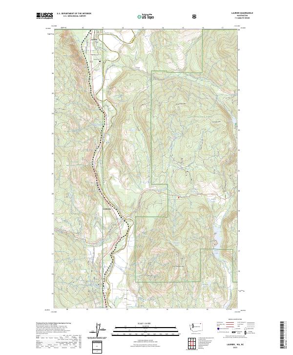
Laurier sits at the northern edge of this terrain, positioned where the Kettle River loops south across the border. The settlement is anchored by the Laurier Cem and the adjacent Avey Field, reflecting the clustered development characteristic of this mountain valley corridor. South of town, the landscape transitions into the heavily timbered reaches of the Colville National Forest, where the topography is defined by prominent peaks like Summit Mtn and First Thought Mtn.
Find a feature on this map
41 named features on this map. Tap any name to fly to it.
Don’t see what you’re looking for? This feature index may not catch every label — zoom into the map to look around manually.
Map Details
Date Portrayed2023
Date Published2023
PublisherU.S. Geological Survey
Map TypeTopographic
Scale1:24000
Physical Dimensions24 x 29 inches
Editions of this 2023 Laurier Map
This is the sole edition of this map. No revisions or reprints were ever made.
Historical Maps of Laurier Through Time

Featured Locations
Source Details
SourceU.S. Geological Survey
CopyrightPublic Domain