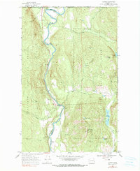
1969 Map of Laurier
USGS Topo · Published 1971About this map
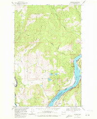
The Kettle River winds southward through the heart of this border region, carving a path between the Ferry and Stevens County line. In the late 1960s, the small settlement of Laurier served as a key port of entry, evidenced by the U S Customs station and the nearby Avey Field landing strip straddling the British Columbia and Washington border. The landscape is defined by its industrial and recreational utility, with the Burlington Northern railroad following the river's contours to support local transport and trade.
Find a feature on this map
47 named features on this map. Tap any name to fly to it.
Don’t see what you’re looking for? This feature index may not catch every label — zoom into the map to look around manually.
Map Details
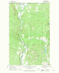
Editions of this 1969 Laurier Map
2 editions found
Other maps of this area

1936 · Marcus
USGS Topo · 1:96,000

1942 · Marcus
USGS Topo · 1:125,000

1948 · Orient
USGS Topo · 1:62,500
1948 · Togo Mountain
USGS Topo · 1:62,500
1951 · Togo Mountain
USGS Topo · 1:62,500

1951 · Orient
USGS Topo · 1:62,500

1954 · Okanogan
USGS Topo · 1:250,000

1958 · Okanogan
USGS Topo · 1:250,000
1969 · Bossburg
USGS Topo · 1:24,000
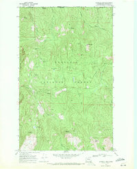
1969 · Churchill Mtn
USGS Topo · 1:24,000