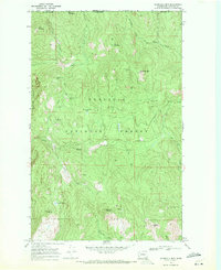
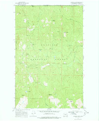
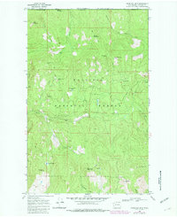
1969 Map of Churchill Mtn
USGS Topo · Published 1971About this map
Hard-rock mining and high mountain peaks dominate this 1960s survey along the Canada United States border in northern Stevens County. Set within the Colville National Forest, the landscape is defined by its industrial extraction sites, including the Easter Sunday Mine, Big Iron Mine, and Churchill Mine. The presence of numerous jeep trails winding between Horns Mountain and Churchill Mtn suggests a period of active exploration and resource management in these highlands.
Find a feature on this map
33 named features on this map. Tap any name to fly to it.
Don’t see what you’re looking for? This feature index may not catch every label — zoom into the map to look around manually.
Map Details
Editions of this 1969 Churchill Mtn Map
3 editions found
Other maps of this area

1929 · Colville
USGS Topo · 1:125,000

1933 · Colville
USGS Topo · 1:125,000

1936 · Marcus
USGS Topo · 1:96,000

1942 · Marcus
USGS Topo · 1:125,000

1948 · Orient
USGS Topo · 1:62,500

1951 · Orient
USGS Topo · 1:62,500

1954 · Okanogan
USGS Topo · 1:250,000

1958 · Okanogan
USGS Topo · 1:250,000

1958 · Sandpoint
USGS Topo · 1:250,000

1963 · Sandpoint
USGS Topo · 1:250,000