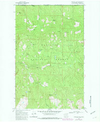
1969 Map of Churchill Mtn
USGS Topo · Published 1982About this map
The Canada United States border forms the northern edge of this rugged landscape in Stevens Co, where mining and high-elevation terrain define the local geography. Significant mineral interest is evident in the cluster of historic operations including the Easter Sunday Mine near Easter Sunday Lake, the Big Iron Mine, and the White Horse Mine. These extraction points sit within the Colville National Forest, highlighting a period when industrial claims and federal wilderness management overlapped in the mountains north of Colville.
Find a feature on this map
35 named features on this map. Tap any name to fly to it.
Don’t see what you’re looking for? This feature index may not catch every label — zoom into the map to look around manually.
Map Details
Editions of this 1969 Churchill Mtn Map
3 editions found
Other maps of this area

1929 · Colville
USGS Topo · 1:125,000

1933 · Colville
USGS Topo · 1:125,000

1936 · Marcus
USGS Topo · 1:96,000

1942 · Marcus
USGS Topo · 1:125,000

1948 · Orient
USGS Topo · 1:62,500

1951 · Orient
USGS Topo · 1:62,500

1954 · Okanogan
USGS Topo · 1:250,000

1958 · Okanogan
USGS Topo · 1:250,000

1958 · Sandpoint
USGS Topo · 1:250,000

1963 · Sandpoint
USGS Topo · 1:250,000