2024 Map of Learned
USGS Topo · Published 2024About this map
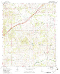
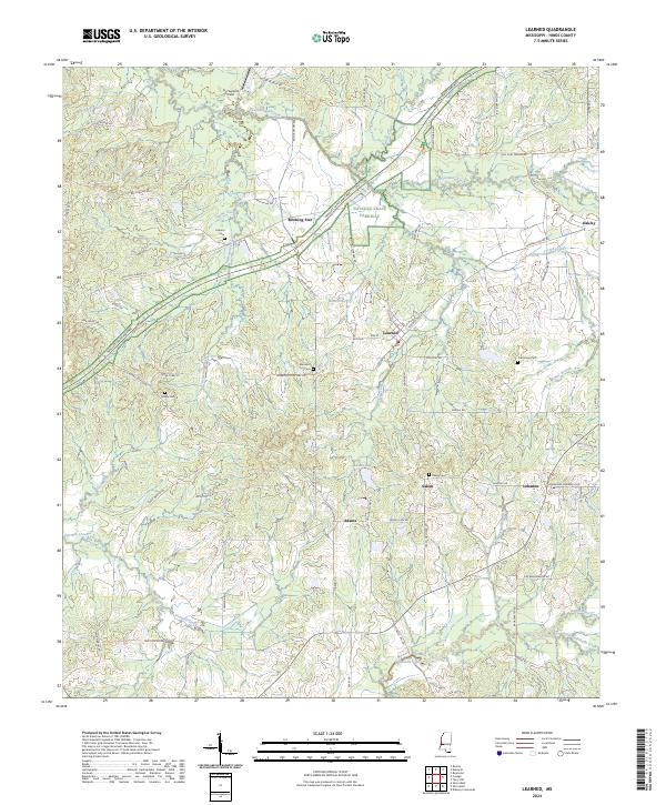
Learned serves as a central hub in this Hinds County landscape, where rural communities like Morning Star, Oakley, and Adams are connected by a network of historic thoroughfares. The Natchez-Trace Parkway cuts diagonally across the northern terrain, shadowing older routes such as Old Port Gibson Rd and Old Adams Station Rd. This survey highlights a high density of family and community burial sites, including Auburn Cem, Nalley Cem, and Oak Grove Cem, which anchor the local genealogy. The physical geography is defined by a dendritic drainage pattern where Fourteenmile Creek and its tributaries, including Twelvemile Creek and Fivemile Creek, navigate the undulating elevations. Small-scale agricultural and residential development is evident near Joe Sanford Field and along Learned Rd, reflecting the sustained rural character of this Mississippi region.
Find a feature on this map
69 named features on this map. Tap any name to fly to it.
Don’t see what you’re looking for? This feature index may not catch every label — zoom into the map to look around manually.
Map Details
Editions of this 2024 Learned Map
This is the sole edition of this map. No revisions or reprints were ever made.