2024 Map of Leesburg
USGS Topo · Published 2024About this map
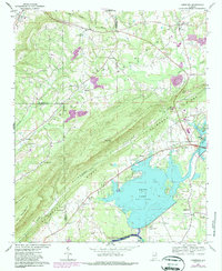
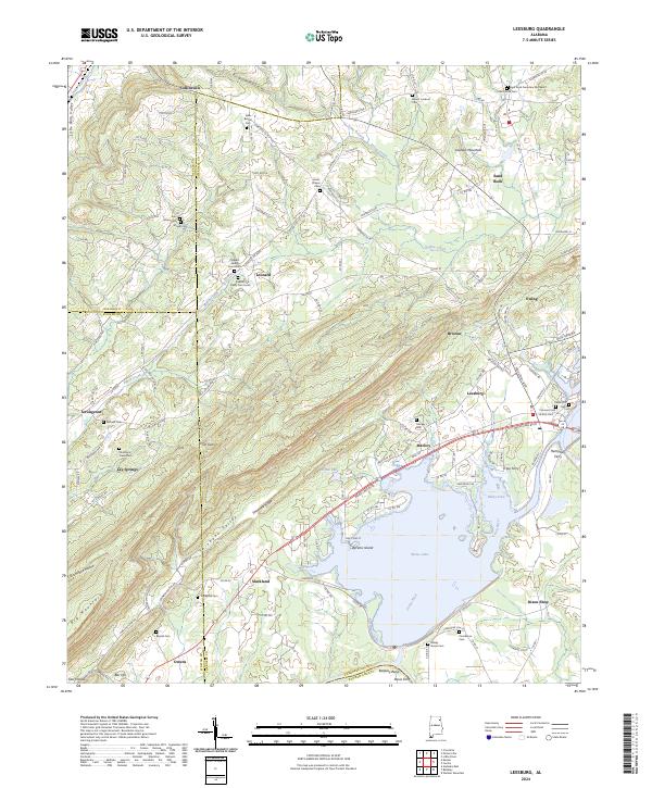
Lookout Mountain dominates the northern landscape of this region, dropping down into the varied terrain of Little Wills Valley and Shinbone Valley. This contemporary survey illustrates the modern configuration of the Coosa River, now widened into the expansive waters of Weiss Lake. The shoreline is punctuated by local landmarks like Byrams Island and Tillery Cove, while the historical importance of river crossings is preserved through labels for Tripp Ferry, Hamptons Ferry, and Davis Ferry. Longstanding community centers are evident in the numerous burial grounds and settlements such as Sand Rock, Leesburg, and Collinsville. The map clearly delineates the tri-county intersection of Cherokee, DeKalb, and Etowah counties, showing how local roads like the Lookout Mt Pkwy navigate the gaps and ridges of the Alabama highlands.
Find a feature on this map
147 named features on this map. Tap any name to fly to it.
Don’t see what you’re looking for? This feature index may not catch every label — zoom into the map to look around manually.
Map Details
Editions of this 2024 Leesburg Map
This is the sole edition of this map. No revisions or reprints were ever made.