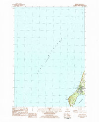
1983 Map of Leland
USGS Topo · Published 1984About this map
Leland occupies the narrow land bridge between the expanse of Lake Michigan and the inland waters of Lake Leelanau. This survey, based on 1970s aerial photography and field checks, shows a community deeply tied to its maritime surroundings. The coastline is defined by prominent Sand features and Carp River Point, while the local infrastructure includes a Pub Boat Ramp and a Light near the harbor entrance. The village street grid is clearly delineated, showing a settlement pattern that balances residential development with the natural constraints of the Leelanau Peninsula. Beyond the primary settlement, the landscape is punctuated by utility features like a Gravel Pit, reflecting the area's geological composition and the resource needs of the late 20th century.
Find a feature on this map
12 named features on this map. Tap any name to fly to it.
Don’t see what you’re looking for? This feature index may not catch every label — zoom into the map to look around manually.
Map Details
Editions of this 1983 Leland Map
This is the sole edition of this map. No revisions or reprints were ever made.
Other maps of this area

1954 · Traverse City
USGS Topo · 1:250,000

1955 · Cheboygan
USGS Topo · 1:250,000

1957 · Traverse City
USGS Topo · 1:62,500

1957 · Northport
USGS Topo · 1:62,500

1957 · Maple City
USGS Topo · 1:62,500

1958 · Cheboygan
USGS Topo · 1:250,000

1958 · Traverse City
USGS Topo · 1:250,000
1983 · Northport NW
USGS Topo · 1:25,000
1983 · Gills Pier
USGS Topo · 1:25,000

1983 · Traverse City
USGS Topo · 1:100,000