Loading...
Loading map...2022 Map of Lena
USGS Topo · Published 2022About this map
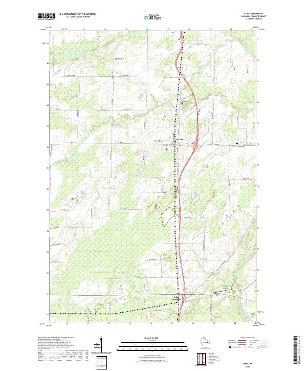
The village of Lena serves as the central hub for this rural Oconto County landscape, situated at the intersection of W Maple St and N Rosera St. The surrounding agricultural lands are partitioned by a dense network of family-named roads, such as Jagiello Rd and Beschta Ln, reflecting the enduring settlement patterns of the region. Local history is anchored by the Lena Cem and Saint Charles Cem, which provide valuable reference points for genealogical research near the town center.
Find a feature on this map
68 named features on this map. Tap any name to fly to it.
Don’t see what you’re looking for? This feature index may not catch every label — zoom into the map to look around manually.
Map Details
Date Portrayed2022
Date Published2022
PublisherU.S. Geological Survey
Map TypeTopographic
Scale1:24000
Physical Dimensions24 x 29 inches
Editions of this 2022 Lena Map
This is the sole edition of this map. No revisions or reprints were ever made.
Historical Maps of Oconto Falls Through Time
Featured Locations
Source Details
SourceU.S. Geological Survey
CopyrightPublic Domain