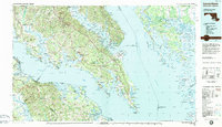
1983 Map of Leonardtown
USGS Topo · Published 1984About this map
Leonardtown serves as the focal point of this Southern Maryland landscape, situated where the Potomac River meets the Chesapeake Bay. The region is defined by its deep maritime and military character, from the historic St Marys City to the expansive Patuxent River Air Test Center near Lexington Park. The map reveals a complex network of peninsulas including Cobb Neck and St Inigoes Neck, as well as the marshy expanse of the Blackwater National Wildlife Refuge across the bay in Dorchester County. Infrastructure of the late twentieth century is prominent, most notably the Calvert Cliffs Nuclear Power Plant and the Naval Surface Weapons Center (Solomons Facility). Cultural preservation is evident at the George Washington Birthplace National Monument along the Virginia shoreline, contrasting with the active naval reservations and river-dependent settlements like Solomons and Colonial Beach.
Find a feature on this map
236 named features on this map. Tap any name to fly to it.
Don’t see what you’re looking for? This feature index may not catch every label — zoom into the map to look around manually.
Map Details
Editions of this 1983 Leonardtown Map
2 editions found
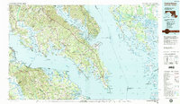
Other maps of this area

1889 · Fredericksburg
USGS Topo · 1:125,000

1890 · Mt. Vernon
USGS Topo · 1:125,000

1891 · Mt. Vernon
USGS Topo · 1:125,000

1892 · Leonardtown
USGS Topo · 1:62,500

1892 · Fredericksburg
USGS Topo · 1:125,000

1892 · Drum Point
USGS Topo · 1:62,500

1892 · Prince Frederick
USGS Topo · 1:62,500

1892 · Brandywine
USGS Topo · 1:62,500

1892 · Piney Point
USGS Topo · 1:62,500

1892 · Montross
USGS Topo · 1:62,500
Featured Places
- Lexington Park, MD
- California, Lexington Park
- Chesapeake Ranch Estates, MD
- Wildewood, Lexington Park
- Colonial Beach, VA