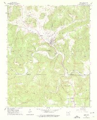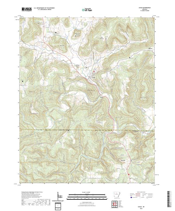
2024 Map of Leslie
USGS Topo · Published 2024About this map
The town of Leslie serves as the primary hub in this portion of the Ozark foothills, situated at the junction of several critical local thoroughfares including Main St and Walnut St. The landscape is defined by the Middle Fork Little Red River and its numerous tributaries such as Cove Creek and Trace Creek, which have carved out distinctive terrain features like Sawmill Hollow and Hollabaugh Hollow. Smaller communities like Noahs and Wileys Cove are linked by a network of county roads that navigate the complex elevation shifts between Blue Mountain and various family-named high points.
Find a feature on this map
107 named features on this map. Tap any name to fly to it.
Don’t see what you’re looking for? This feature index may not catch every label — zoom into the map to look around manually.
Map Details
Editions of this 2024 Leslie Map
This is the sole edition of this map. No revisions or reprints were ever made.