Loading...
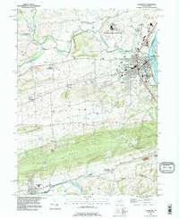
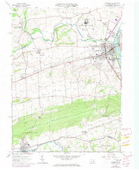
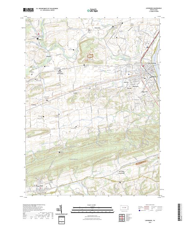
Loading map...1994 Map of Lewisburg
USGS Topo · Published 1996About this map
The West Branch Susquehanna River anchors the eastern edge of this region, where the town of Lewisburg serves as a hub for both education and industry. The campus of Bucknell University and the Lewisburg Federal Penitentiary are prominent landmarks, reflecting the institutional history of Union County. To the west, the fertile Buffalo Valley is dotted with long-standing rural settlements like Buffalo Crossroads and Mazeppa.
Find a feature on this map
63 named features on this map. Tap any name to fly to it.
Don’t see what you’re looking for? This feature index may not catch every label — zoom into the map to look around manually.
Map Details
Date Portrayed1994
Date Published1996
PublisherU.S. Geological Survey
Map TypeTopographic
Scale1:24,000
Physical Dimensions22.1 x 27 inches
Editions of this 1994 Lewisburg Map
This is the sole edition of this map. No revisions or reprints were ever made.
Historical Maps of Lewisburg Through Time
7 maps found
Featured Locations
- Monroe Township, PA
- Buffalo Township, PA
- Lewisburg, PA
- Lochiel, East Buffalo Township
- Buffalo Crossroads, Buffalo Township
Source Details
SourceU.S. Geological Survey
CopyrightPublic Domain