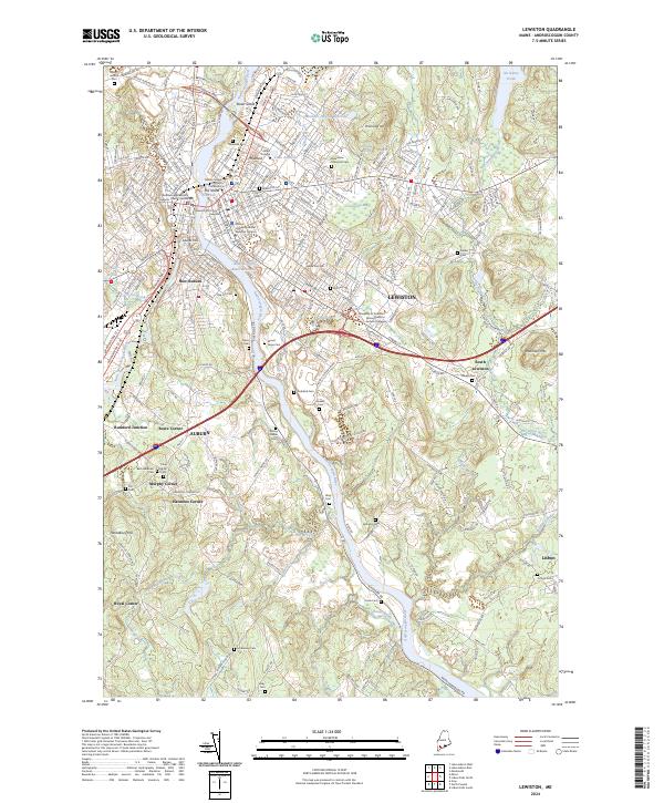
2024 Map of Lewiston
USGS Topo · Published 2024About this map
The Androscoggin River serves as the central artery for this twin-city region, dividing Lewiston and Auburn. This modern survey reveals a landscape where institutional campuses like Bates College and the University of Southern Maine-Lewiston - Auburn College anchor the urban core, while a dense network of cemeteries, including Beth Abraham Cem and Mount Hope Cem, provides significant data for genealogical research. The transition from industrial city centers to rural outskirts is marked by named crossroads such as Murphy Corner, Royal Corner, and Harmons Corner. Outside the urban grid, the geography is defined by natural features like the Garcelon Bog and the Montello Heights Reservoir. Notable landforms such as Thorncrag Hill and Robinson Mtn rise above the river valley, while smaller waterways like Soper Mill Brook and No Name Brook drain the surrounding hillsides.
Find a feature on this map
70 named features on this map. Tap any name to fly to it.
Don’t see what you’re looking for? This feature index may not catch every label — zoom into the map to look around manually.
Map Details
Editions of this 2024 Lewiston Map
This is the sole edition of this map. No revisions or reprints were ever made.
Other maps of this area

1892 · Freeport
USGS Topo · 1:62,500

1894 · Gray
USGS Topo · 1:62,500

1898 · Gray
USGS Topo · 1:62,500

1908 · Poland
USGS Topo · 1:62,500

1908 · Lewiston
USGS Topo · 1:62,500

1940 · Poland
USGS Topo · 1:62,500

1941 · Freeport
USGS Topo · 1:62,500

1942 · Lewiston
USGS Topo · 1:62,500

1942 · Poland
USGS Topo · 1:62,500

1942 · Gray
USGS Topo · 1:62,500