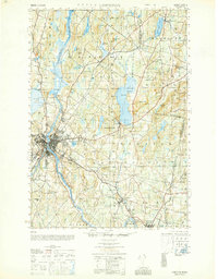
1950 Map of Lewiston
USGS Topo · Published 1950About this map
The Androscoggin River carves a path through the heart of this post-war Maine landscape, anchoring the industrial and residential centers of Lewiston and New Auburn. This 1950 survey, based on late-1930s aerial photography, reveals a region defined by its water-powered past and its rail-connected future. To the east, the expansive Sabattus Pond is overlooked by Sabattus Mtn, while the smaller industrial hub of Lisbon Falls sits near the southern boundary.
Find a feature on this map
92 named features on this map. Tap any name to fly to it.
Don’t see what you’re looking for? This feature index may not catch every label — zoom into the map to look around manually.
Map Details
Editions of this 1950 Lewiston Map
This is the sole edition of this map. No revisions or reprints were ever made.
Other maps of this area

1892 · Gardiner
USGS Topo · 1:62,500

1892 · Freeport
USGS Topo · 1:62,500

1892 · Augusta
USGS Topo · 1:62,500

1894 · Gray
USGS Topo · 1:62,500

1894 · Bath
USGS Topo · 1:62,500

1898 · Gray
USGS Topo · 1:62,500

1908 · Poland
USGS Topo · 1:62,500

1908 · Lewiston
USGS Topo · 1:62,500

1910 · Livermore
USGS Topo · 1:62,500

1911 · Buckfield
USGS Topo · 1:62,500