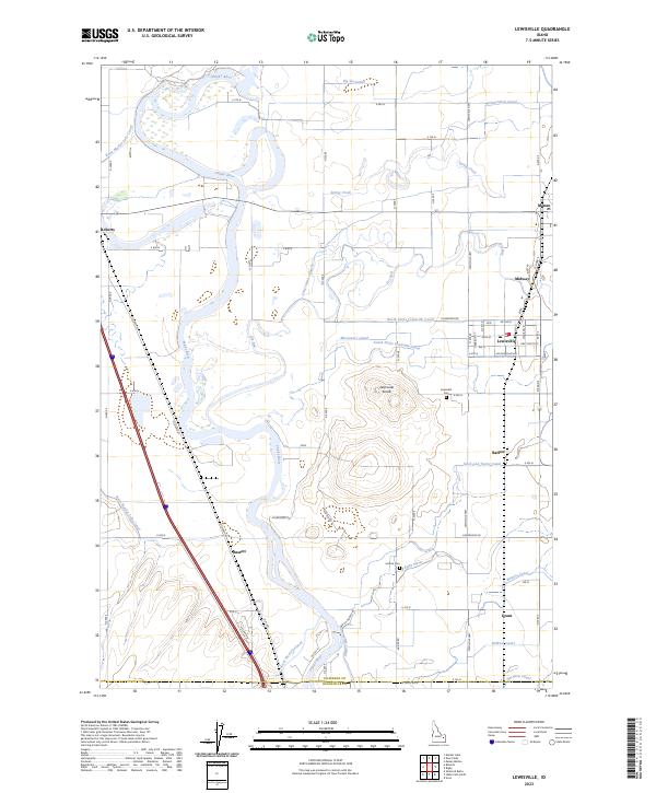
2023 Map of Lewisville
USGS Topo · Published 2023About this map
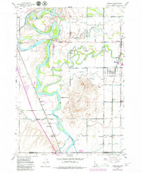
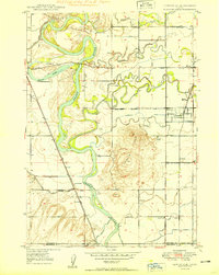
The Snake River carves a winding path through this corner of the Snake River Plain, where an intricate network of irrigation channels has defined the landscape and local economy for generations. This survey details the complex water management system that supports the agricultural communities of Lewisville, Roberts, and Menan, featuring a dense lattice of waterways such as the Big Six Canal, Long Island Canal, and the Great Western Canal. The topography is generally level, punctuated most notably by the Lewisville Knolls, which rise above the surrounding fields east of the river. Historically significant sites for genealogists include the Lewisville Cem and Central Cem, alongside smaller settlements like Bassett and Grant that serve as anchor points for the rural road grid.
Find a feature on this map
54 named features on this map. Tap any name to fly to it.
Don’t see what you’re looking for? This feature index may not catch every label — zoom into the map to look around manually.
Map Details
Editions of this 2023 Lewisville Map
This is the sole edition of this map. No revisions or reprints were ever made.
Historical Maps of Menan Through Time
3 maps found