2024 Map of Liberty
USGS Topo · Published 2024About this map
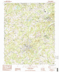
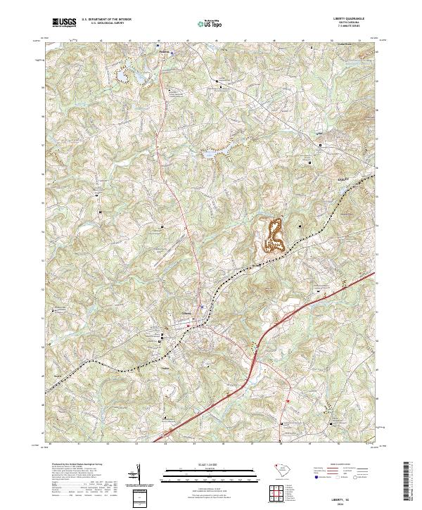
The town of Liberty serves as a central hub for this portion of Pickens County, situated where the Pickens Railroad meets major thoroughfares. This contemporary survey shows a landscape where suburban expansion from nearby Easley and the settlement at Arial meets a deep-rooted network of rural cemeteries and churches. Notable genealogy sites are scattered throughout the hills, including the Bethlehem United Methodist Church Graveyard and Carmel Presbyterian Church Graveyard. To the north, the terrain rises toward Arial Mountain, while the southern landscape is defined by the winding paths of Eighteenmile Creek and Golden Creek. The presence of the Pickens County Airport and the sprawling Country Club Lake indicate the area's development into a regional center for both transit and recreation, even as small communities like Norris, Traber, and Beverly maintain their distinct local identities.
Find a feature on this map
258 named features on this map. Tap any name to fly to it.
Don’t see what you’re looking for? This feature index may not catch every label — zoom into the map to look around manually.
Map Details
Editions of this 2024 Liberty Map
This is the sole edition of this map. No revisions or reprints were ever made.