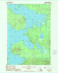
1989 Map of Lily Bay
USGS Topo · Published 1989About this map
Moosehead Lake dominates this late-1980s topography, framing the irregular shorelines and islands of Piscataquis County. The survey illustrates a landscape defined by water and high relief, from the significant mass of Sugar Island to the prominent peak of Burnt Jacket Mtn. Public and institutional land use is evident in the presence of Lily Bay State Park and the large expanse of the Bowdoin College Grant West, reflecting the region’s long-standing patterns of conservation and timber management. Settlements such as Greenville and Beaver Cove occupy the lower reaches of the map, connected by winding routes that navigate between water bodies like Prong Pond and Mud Pond. Numerous points and coves, including Caribou Pt and Galusha Cove, document the intricate geography of Maine's largest lake before further modern development.
Find a feature on this map
45 named features on this map. Tap any name to fly to it.
Don’t see what you’re looking for? This feature index may not catch every label — zoom into the map to look around manually.
Map Details
Editions of this 1989 Lily Bay Map
This is the sole edition of this map. No revisions or reprints were ever made.
Other maps of this area

1920 · Moosehead Lake
USGS Topo · 1:62,500

1922 · Moosehead Lake
USGS Topo · 1:62,500

1930 · Moosehead Lake
USGS Topo · 1:62,500

1944 · Moosehead Lake
USGS Topo · 1:62,500

1950 · Sebec Lake
USGS Topo · 1:62,500

1951 · Greenville
USGS Topo · 1:62,500

1952 · First Roach Pond
USGS Topo · 1:62,500

1954 · Millinocket
USGS Topo · 1:250,000

1957 · Moosehead Lake
USGS Topo · 1:62,500

1958 · Millinocket
USGS Topo · 1:250,000
Featured Places
- Greenville, ME
- Beaver Cove, ME
- Lily Bay Township, ME
- Harfords Point Township, ME
- Bowdoin College Grant West Township, ME