2024 Map of Limestone
USGS Topo · Published 2024About this map
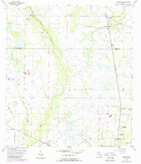
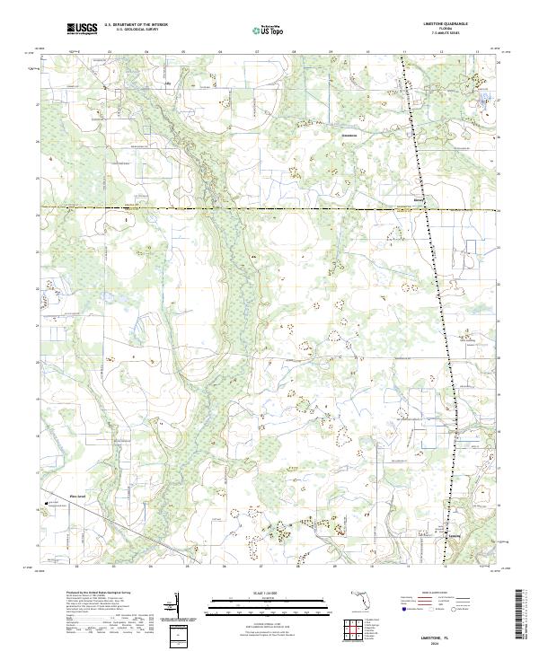
Horse Creek and its broad, marshy corridor define the center of this rural landscape, flowing south through the borderlands between Hardee and DeSoto counties. This recent survey documents the dispersed agricultural settlements of Lily, Kinsey, and Limestone, connected by a network of rural roads like Co Rd 665 and Lily Grade Rd. To the south, the historical importance of Pine Level is preserved at the Pine Level Campground Cem, while the southeast corner touches the Peace River near Lansing and Ott's Landing. The mapping of these small crossroads and family-named landmarks like Cloud Nine Rnch provides a clear view of the current land use and settlement patterns in this part of Florida's interior, where legacy cattle ranching and farming tracts remain the primary features of the terrain.
Find a feature on this map
61 named features on this map. Tap any name to fly to it.
Don’t see what you’re looking for? This feature index may not catch every label — zoom into the map to look around manually.
Map Details
Editions of this 2024 Limestone Map
This is the sole edition of this map. No revisions or reprints were ever made.