1956 Map of Limestone
USGS Topo · Published 1987About this map
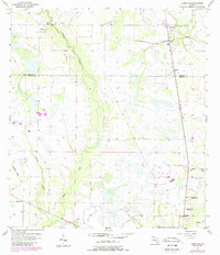
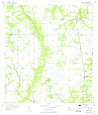
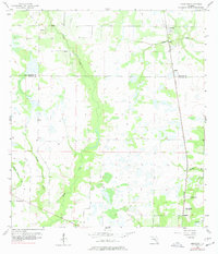
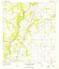
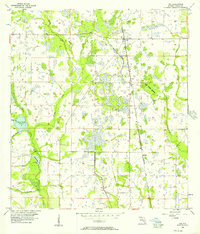
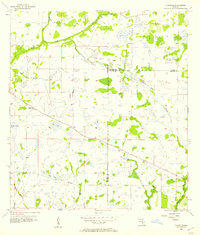
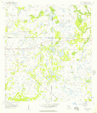
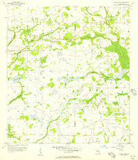
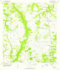
Horse Creek meanders through the center of this South Florida landscape, defining a wide basin of wetlands and hammocks along the boundary of Hardee and De Soto Counties. The settlement pattern in the mid-1950s follows the north-south corridor of the CSX railroad, which links the small communities of Limestone, Kinsey, and Lansing. These rural outposts are characterized by small churches and schools that served the local agricultural and timbering families, such as Lily Ch in the north and Oak Hill Ch near the southern edge of the survey.
Find a feature on this map
15 named features on this map. Tap any name to fly to it.
Don’t see what you’re looking for? This feature index may not catch every label — zoom into the map to look around manually.
Map Details
Editions of this 1956 Limestone Map
4 editions found
Other maps of this area
1956 · Gardner
USGS Topo · 1:24,000
1956 · Ona
USGS Topo · 1:24,000
1956 · Edgeville
USGS Topo · 1:24,000
1956 · Murdock NE
USGS Topo · 1:24,000
1956 · Myakka Head
USGS Topo · 1:24,000
1956 · Limestone
USGS Topo · 1:24,000
1956 · Zolfo Springs
USGS Topo · 1:24,000
1956 · Nocatee
USGS Topo · 1:24,000

1956 · Tampa
USGS Topo · 1:250,000

1956 · Fort Pierce
USGS Topo · 1:250,000