1956 Map of Limestone
USGS Topo · Published 1974About this map
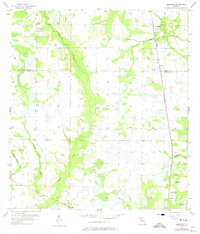
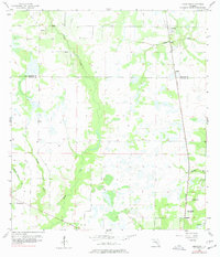
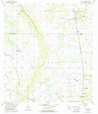
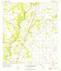
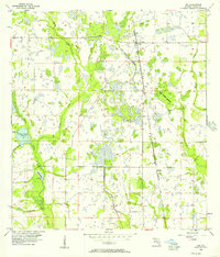
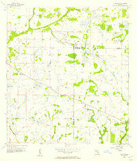
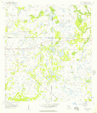
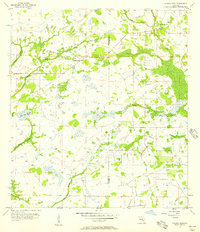
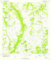
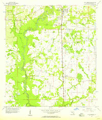
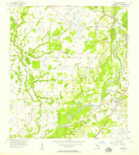
Pine Level and Limestone anchor this mid-century look at the rural landscape of Florida’s heartland, where the boundary between Hardee and De Soto counties meets a network of slow-moving waterways. The map illustrates a region defined by its reliance on the Seaboard Air Line railroad and the drainage basins of Horse Creek and the Peace R. A notable local landmark is the Oak Hill Sch, marked as abandoned by the mid-1950s, standing near Oak Hill Ch and the settlement of Lansing. These details, alongside churches like Lily Ch, provide a window into the shifting rural population centers of the era. The terrain is a complex of small branches and creeks, including Brandy Branch, Walker Br, and Buzzard Roost Br, which dictate the placement of local roads and farmsteads.
Find a feature on this map
18 named features on this map. Tap any name to fly to it.
Don’t see what you’re looking for? This feature index may not catch every label — zoom into the map to look around manually.
Map Details
Editions of this 1956 Limestone Map
4 editions found
Other maps of this area
1956 · Gardner
USGS Topo · 1:24,000
1956 · Ona
USGS Topo · 1:24,000
1956 · Edgeville
USGS Topo · 1:24,000
1956 · Murdock NE
USGS Topo · 1:24,000
1956 · Myakka Head
USGS Topo · 1:24,000
1956 · Limestone
USGS Topo · 1:24,000
1956 · Zolfo Springs
USGS Topo · 1:24,000
1956 · Nocatee
USGS Topo · 1:24,000

1956 · Tampa
USGS Topo · 1:250,000

1956 · Fort Pierce
USGS Topo · 1:250,000