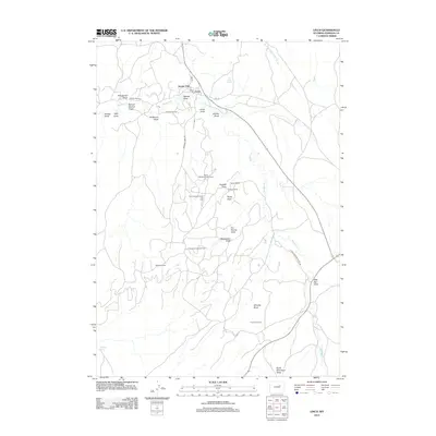
2012 Map of Linch
USGS Topo · Published 2012About this map
Linch serves as the central hub of this northern Wyoming landscape, where the energy industry and traditional ranching intersect. The map documents an extensive network of petroleum infrastructure, most notably the Sussex Oil Field, North Meadow Creek Oil Field, and Meadow Creek Oil Field. These industrial zones are connected by a web of local roads such as Meadow Creek Rd and Sussex Field Rd, which navigate a terrain defined by a complex system of drainage features.
Find a feature on this map
35 named features on this map. Tap any name to fly to it.
Don’t see what you’re looking for? This feature index may not catch every label — zoom into the map to look around manually.
Map Details
Editions of this 2012 Linch Map
This is the sole edition of this map. No revisions or reprints were ever made.
Other maps of this area

1953 · Dry Fork Ranch
USGS Topo · 1:24,000

1954 · House Creek
USGS Topo · 1:24,000

1954 · Linch
USGS Topo · 1:24,000

1954 · Taylor Ranch
USGS Topo · 1:24,000

1955 · Arminto
USGS Topo · 1:250,000

1958 · Arminto
USGS Topo · 1:250,000

1959 · Edgerton
USGS Topo · 1:62,500

1961 · Dead Woman Crossing
USGS Topo · 1:24,000
1961 · Sussex
USGS Topo · 1:24,000

1962 · Arminto
USGS Topo · 1:250,000