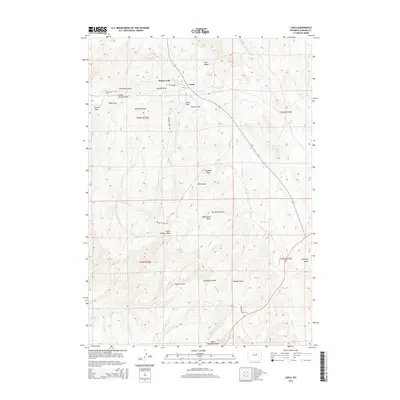
2015 Map of Linch
USGS Topo · Published 2015About this map
Linch and the nearby Sussex Unit anchor this high plains landscape in Johnson County, where the topography is defined by an intricate network of ephemeral drainages known as draws. These landforms, including Frenchman Draw, Moonshine Draw, and Joe Begant Draw, create a complex natural drainage system that feeds into Meadow Cr and the W Fork Bullwhacker Cr. The presence of reliable water sources like Joe Grey Spring and Knighton Spring highlights the critical importance of localized hydrology in this arid environment.
Find a feature on this map
33 named features on this map. Tap any name to fly to it.
Don’t see what you’re looking for? This feature index may not catch every label — zoom into the map to look around manually.
Map Details
Editions of this 2015 Linch Map
This is the sole edition of this map. No revisions or reprints were ever made.
Other maps of this area

1953 · Dry Fork Ranch
USGS Topo · 1:24,000

1954 · House Creek
USGS Topo · 1:24,000

1954 · Linch
USGS Topo · 1:24,000

1954 · Taylor Ranch
USGS Topo · 1:24,000

1955 · Arminto
USGS Topo · 1:250,000

1958 · Arminto
USGS Topo · 1:250,000

1959 · Edgerton
USGS Topo · 1:62,500

1961 · Dead Woman Crossing
USGS Topo · 1:24,000
1961 · Sussex
USGS Topo · 1:24,000

1962 · Arminto
USGS Topo · 1:250,000