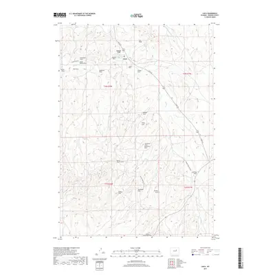
2017 Map of Linch
USGS Topo · Published 2017About this map
Linch serves as the primary hub in this corner of Johnson County, situated in a landscape defined by an intricate network of ephemeral watercourses. This area, dominated by the Sussex Unit, is marked by numerous family-named landmarks and local drainages that speak to the ranching and resource history of the region. Distinctive features like School Section Draw, Frenchman Draw, and Nick Ray Draw provide clear evidence of how the land was partitioned and named by early inhabitants.
Find a feature on this map
33 named features on this map. Tap any name to fly to it.
Don’t see what you’re looking for? This feature index may not catch every label — zoom into the map to look around manually.
Map Details
Editions of this 2017 Linch Map
This is the sole edition of this map. No revisions or reprints were ever made.
Other maps of this area

1953 · Dry Fork Ranch
USGS Topo · 1:24,000

1954 · House Creek
USGS Topo · 1:24,000

1954 · Linch
USGS Topo · 1:24,000

1954 · Taylor Ranch
USGS Topo · 1:24,000

1955 · Arminto
USGS Topo · 1:250,000

1958 · Arminto
USGS Topo · 1:250,000

1959 · Edgerton
USGS Topo · 1:62,500

1961 · Dead Woman Crossing
USGS Topo · 1:24,000
1961 · Sussex
USGS Topo · 1:24,000

1962 · Arminto
USGS Topo · 1:250,000