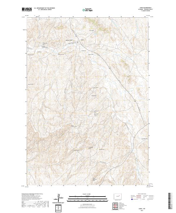
2021 Map of Linch
USGS Topo · Published 2021About this map
Linch sits as a lonely hub within a landscape of deeply etched drainages and high ridges in Johnson County. This area is defined by its complex network of named draws, including Fay Dennis Draw, Moonshine Draw, and School Section Draw, which reveal the intensive survey of this arid terrain for local resource management. The map details the Sussex Unit and the winding course of Sussex Rd, tracing the pathways that connect isolated homesteads and ranching outposts. Water sources like Joe Grey Spring and Knighton Spring are vital landmarks in this high-plains environment, where Meadow Cr and the forks of Bullwhacker Creek provide the primary relief. The naming conventions throughout the territory, such as Pugsley Draw and Nick Ray Draw, suggest a deeply personal history of land use and family presence in the Wyoming backcountry.
Find a feature on this map
35 named features on this map. Tap any name to fly to it.
Don’t see what you’re looking for? This feature index may not catch every label — zoom into the map to look around manually.
Map Details
Editions of this 2021 Linch Map
This is the sole edition of this map. No revisions or reprints were ever made.
Other maps of this area

1953 · Dry Fork Ranch
USGS Topo · 1:24,000

1954 · House Creek
USGS Topo · 1:24,000

1954 · Linch
USGS Topo · 1:24,000

1954 · Taylor Ranch
USGS Topo · 1:24,000

1955 · Arminto
USGS Topo · 1:250,000

1958 · Arminto
USGS Topo · 1:250,000

1959 · Edgerton
USGS Topo · 1:62,500

1961 · Dead Woman Crossing
USGS Topo · 1:24,000
1961 · Sussex
USGS Topo · 1:24,000

1962 · Arminto
USGS Topo · 1:250,000