
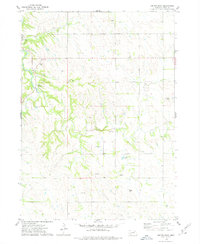
1974 Map of Lindy
USGS Topo · Published 1978About this map
Lindy serves as the primary focal point of this northeastern Nebraska landscape, situated just east of the Santee Indian Reservation Boundary. The terrain is defined by a network of drainage systems, including the southward-flowing Hobo Creek and the meandering Weigand Creek in the east. This 1974 survey captures the rural agricultural character of Knox County during the mid-1970s, showing a sparse distribution of farmsteads and rural infrastructure such as a remote Substation. The topographic detail highlights the high ground at Peoria, providing a clear view of how early land management and boundary lines intersected with the natural drainage of the Missouri River valley region.
Find a feature on this map
6 named features on this map. Tap any name to fly to it.
Don’t see what you’re looking for? This feature index may not catch every label — zoom into the map to look around manually.
Map Details
Editions of this 1974 Lindy Map
This is the sole edition of this map. No revisions or reprints were ever made.
Other maps of this area

1955 · Sioux City
USGS Topo · 1:250,000

1958 · Sioux City
USGS Topo · 1:250,000

1959 · Sioux City
USGS Topo · 1:250,000

1968 · Tabor SE
USGS Topo · 1:24,000

1968 · Bloomfield NE
USGS Topo · 1:24,000

1968 · Bloomfield SE
USGS Topo · 1:24,000

1974 · Bloomfield
USGS Topo · 1:24,000
1974 · Center East
USGS Topo · 1:24,000

1974 · Howe Creek
USGS Topo · 1:24,000

1974 · Bon Homme Colony
USGS Topo · 1:24,000