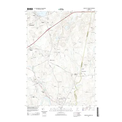
2014 Map of Lisbon Falls North
USGS Topo · Published 2014About this map
Sabattus Pond and the Sabattus River anchor the western portion of this terrain, where the landscape transitions from the outskirts of Lewiston through several historic crossroads. These small hubs, such as Drinkwater Corner, Robinson Corner, and Higgins Corner, illustrate the traditional Maine settlement pattern of rural communities centered on key intersections and local industry. The map captures the area around Lisbon Falls and Lisbon Center as they sit along the Androscoggin River, highlighting the importance of river corridors for regional development.
Find a feature on this map
125 named features on this map. Tap any name to fly to it.
Don’t see what you’re looking for? This feature index may not catch every label — zoom into the map to look around manually.
Map Details
Editions of this 2014 Lisbon Falls North Map
This is the sole edition of this map. No revisions or reprints were ever made.
Other maps of this area

1892 · Gardiner
USGS Topo · 1:62,500

1892 · Freeport
USGS Topo · 1:62,500

1894 · Bath
USGS Topo · 1:62,500

1908 · Lewiston
USGS Topo · 1:62,500

1920 · Bath
USGS Topo · 1:62,500

1941 · Freeport
USGS Topo · 1:62,500

1942 · Lewiston
USGS Topo · 1:62,500

1943 · Gardiner
USGS Topo · 1:62,500

1944 · Freeport
USGS Topo · 1:62,500

1945 · Bath
USGS Topo · 1:62,500