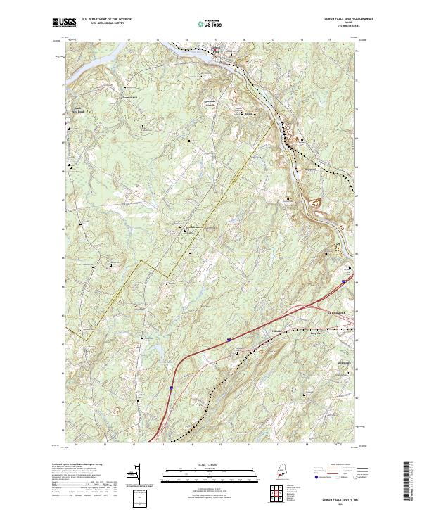
2024 Map of Lisbon Falls South
USGS Topo · Published 2024About this map
The Androscoggin River winds through this region where the borders of Androscoggin, Sagadahoc, and Cumberland Counties converge. Small crossroads and hamlets like South Durham, Crossman Corner, and Pejepscot are connected by a network of historic routes including Quaker Meeting House Rd and Old Brunswick Rd. The landscape is notably punctuated by numerous small family and community burial grounds, such as the Gerrish Family Cem and the Old North Meeting House Cem, alongside individual markers like the Noah Elliot Grave.
Find a feature on this map
168 named features on this map. Tap any name to fly to it.
Don’t see what you’re looking for? This feature index may not catch every label — zoom into the map to look around manually.
Map Details
Editions of this 2024 Lisbon Falls South Map
This is the sole edition of this map. No revisions or reprints were ever made.
Other maps of this area

1892 · Gardiner
USGS Topo · 1:62,500

1892 · Freeport
USGS Topo · 1:62,500

1894 · Bath
USGS Topo · 1:62,500

1908 · Lewiston
USGS Topo · 1:62,500

1920 · Bath
USGS Topo · 1:62,500

1941 · Freeport
USGS Topo · 1:62,500

1942 · Lewiston
USGS Topo · 1:62,500

1943 · Gardiner
USGS Topo · 1:62,500

1944 · Freeport
USGS Topo · 1:62,500

1945 · Bath
USGS Topo · 1:62,500