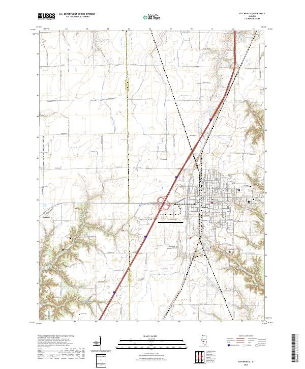
2024 Map of Litchfield
USGS Topo · Published 2024About this map
Litchfield sits at a crossroads of central Illinois transport and history, serving as a hub where major thoroughfares and rail corridors intersect. The landscape is defined by the drainage of Cahokia Creek and Shop Creek, with several reservoirs such as Kilton Lake and Walton Lake punctuating the terrain. For those tracing family roots in Montgomery and Macoupin counties, the map is remarkably dense with burial grounds, including Karnes Cem, Kinder Cem, Crabtree Cem, and Farrar Cem, alongside the larger Elmwood Cem and Holy Cross Cem near the city center. To the west, the smaller settlement of Hornsby is situated near the Macoupin Co line, maintaining its distinct identity amidst a grid of rural routes like Niehaus Rd and Schwab Rd. Modern aviation history is represented by the Litchfield Municipal Airport, which occupies a significant portion of the area south of the primary townsite.
Find a feature on this map
133 named features on this map. Tap any name to fly to it.
Don’t see what you’re looking for? This feature index may not catch every label — zoom into the map to look around manually.
Map Details
Editions of this 2024 Litchfield Map
This is the sole edition of this map. No revisions or reprints were ever made.
Other maps of this area

1912 · Gillespie
USGS Topo · 1:62,500

1915 · Gillespie
USGS Topo · 1:62,500

1915 · Mount Olive
USGS Topo · 1:62,500

1923 · Carlinville
USGS Topo · 1:48,000

1923 · Raymond
USGS Topo · 1:62,500

1925 · Carlinville
USGS Topo · 1:62,500

1925 · Raymond
USGS Topo · 1:62,500

1931 · Carlinville
USGS Topo · 1:62,500

1944 · Mount Olive
USGS Topo · 1:62,500

1958 · Decatur
USGS Topo · 1:250,000