Loading...
Loading map...2024 Map of Literberry
USGS Topo · Published 2024About this map
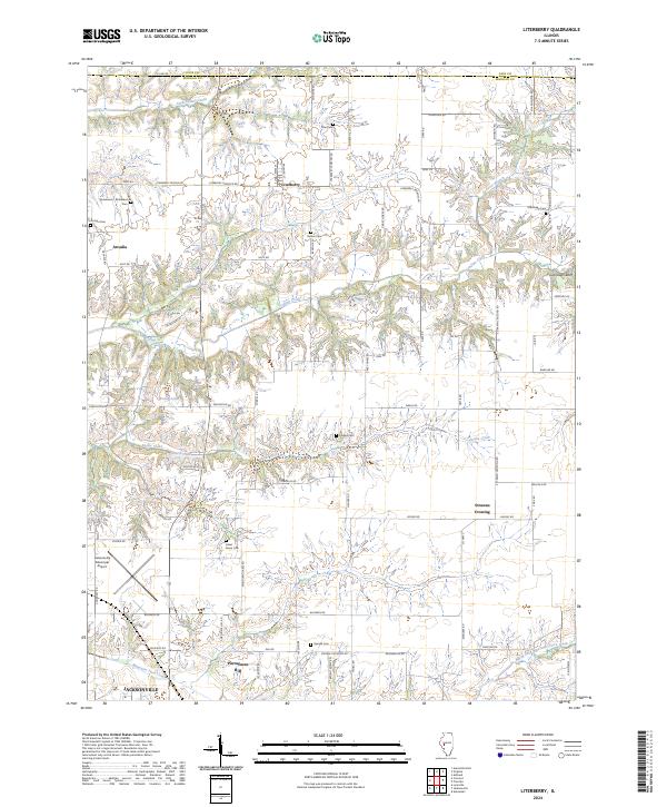
Literberry stands as the primary settlement in this agricultural landscape north of Jacksonville, where the flat prairie gives way to the carved drainage basins of Indian Creek and Snake Creek. The map reveals a dense network of country roads named for the families and destinations they served, such as Literberry Triopia Rd and Conover Rd. Genealogical value is high throughout the township, with numerous small burial grounds like Sample Cem and Rucker Cem preserved amidst the fields.
Find a feature on this map
79 named features on this map. Tap any name to fly to it.
Don’t see what you’re looking for? This feature index may not catch every label — zoom into the map to look around manually.
Map Details
Date Portrayed2024
Date Published2024
PublisherU.S. Geological Survey
Map TypeTopographic
Scale1:24000
Physical Dimensions24 x 29 inches
Editions of this 2024 Literberry Map
This is the sole edition of this map. No revisions or reprints were ever made.
Historical Maps of Jacksonville Through Time
Featured Locations
Source Details
SourceU.S. Geological Survey
CopyrightPublic Domain