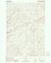
1990 Map of Little Black Canyon
USGS Topo · Published 1990About this map
Lawrence Ranch sits at the heart of this high-desert drainage system in eastern Oregon, representing the localized ranching operations that defined Malheur County's land use during the late twentieth century. The landscape is characterized by a sophisticated network of small-scale water management features, including Annies Reservoir, Pence Spring Reservoir, and Negro Rock Reservoir, which highlight the critical importance of water rights and storage in this arid environment. The map details the intricate branching of Cottonwood Creek, with its West Fork and South Fork tributaries carving through the terrain. To the east, the Little Black Canyon and the winding Willow Spring Creek illustrate the topographical variation of the region. These managed water points, such as Hog Creek Reservoir No 1 and Allotment Reservoir No 3, provide a clear picture of how the livestock industry adapted to the geography of the high plateau.
Find a feature on this map
17 named features on this map. Tap any name to fly to it.
Don’t see what you’re looking for? This feature index may not catch every label — zoom into the map to look around manually.
Map Details
Editions of this 1990 Little Black Canyon Map
This is the sole edition of this map. No revisions or reprints were ever made.
Other maps of this area

1955 · Baker
USGS Topo · 1:250,000

1955 · Boise
USGS Topo · 1:250,000

1958 · Boise
USGS Topo · 1:250,000

1959 · Baker
USGS Topo · 1:250,000

1962 · Boise
USGS Topo · 1:250,000

1964 · Brogan
USGS Topo · 1:62,500

1966 · Clover Creek Ranch
USGS Topo · 1:62,500

1966 · Harper
USGS Topo · 1:62,500

1966 · Westfall Butte
USGS Topo · 1:62,500

1980 · Brogan
USGS Topo · 1:100,000