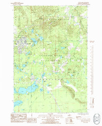
1985 Map of Little Lake
USGS Topo · Published 1985About this map
K I Sawyer Air Force Base dominates the northwestern portion of this mid-1980s survey, showing a complex of residential streets and educational facilities like the Leo P Mc Donald Sch. The landscape is defined by the Escanaba River State Forest, where a high density of water bodies including Silver Lake and Sporley Lake dot the glacial terrain. In the southern half, the settlement of Little Lake serves as a local hub, featuring the Little Lake Campground Boat Ramp and remnants of earlier industrial infrastructure indicated by an Old RR Grade. The eastern reaches transition into the lower elevations of the Cyr Swamp and the winding course of the Chocolay River. This map captures a specific moment in the military and recreational history of the Upper Peninsula, balancing the structured layout of the air base against the surrounding wilderness of Forsyth township.
Find a feature on this map
49 named features on this map. Tap any name to fly to it.
Don’t see what you’re looking for? This feature index may not catch every label — zoom into the map to look around manually.
Map Details
Editions of this 1985 Little Lake Map
This is the sole edition of this map. No revisions or reprints were ever made.
Other maps of this area

1932 · Skandia SW
USGS Topo · 1:31,680

1932 · Helena NW
USGS Topo · 1:31,680

1932 · Helena NE
USGS Topo · 1:31,680

1932 · Harvey NW
USGS Topo · 1:31,680

1932 · Harvey SE
USGS Topo · 1:31,680

1932 · Harvey SW
USGS Topo · 1:31,680

1932 · Rock NW
USGS Topo · 1:31,680

1932 · Harvey NE
USGS Topo · 1:31,680

1950 · Skandia NW
USGS Topo · 1:31,680

1951 · Helena NE
USGS Topo · 1:31,680