2023 Map of Lloyd Harbor
USGS Topo · Published 2023About this map
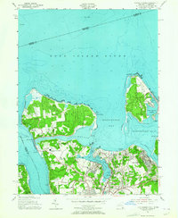
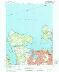
Sagamore Hill National Historic Site anchors the western edge of this coastal landscape, preserving the estate of Theodore Roosevelt overlooking Oyster Bay. The North Shore of Long Island is defined here by deep harbors and narrow necks, including Lloyd Neck and Eatons Neck, which create a complex network of sheltered water bodies like Huntington Harbor and Duck Island Harbor. This modern survey reveals a highly developed residential shoreline where historic industry meets conservation efforts.
Find a feature on this map
72 named features on this map. Tap any name to fly to it.
Don’t see what you’re looking for? This feature index may not catch every label — zoom into the map to look around manually.
Map Details
Editions of this 2023 Lloyd Harbor Map
This is the sole edition of this map. No revisions or reprints were ever made.
Historical Maps of Oyster Bay Cove Through Time
3 maps found