2024 Map of Lockesburg
USGS Topo · Published 2024About this map
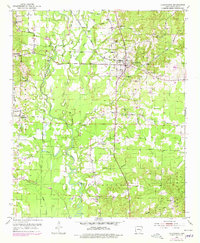
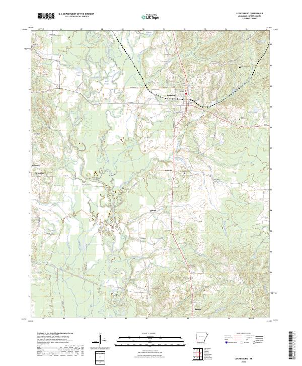
Lockesburg serves as the central hub of this Sevier County landscape, where the confluence of the Cossatot River and the Little Cossatot River creates a complex network of waterways. The surrounding terrain is defined by seasonal drainages and sluggish channels like Borne Mill Slough and White Oak Slough, which weave through the lowlands north of the Pond Creek National Wildlife Refuge. The map reveals a settlement pattern of small communities such as Bellville, Milrose, and Pennys, often anchored by family and community landmarks like the Bellville Cem and Coulter Memorial Garden. Historical transport is represented by the Old Confederate Rd, while the eastern portion of the quadrangle shows the riparian environment around Coulter Lake and Sycamore Creek. These features illustrate the enduring connection between the local population and the river-bottom geography of southwest Arkansas.
Find a feature on this map
87 named features on this map. Tap any name to fly to it.
Don’t see what you’re looking for? This feature index may not catch every label — zoom into the map to look around manually.
Map Details
Editions of this 2024 Lockesburg Map
This is the sole edition of this map. No revisions or reprints were ever made.