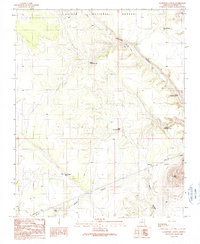
1989 Map of Lockwood Canyon
USGS Topo · Published 1990About this map
Kaibab National Forest dominates this section of the Coconino plateau, where the landscape is defined by the deep incisions of Lockwood Canyon and Rabbit Canyon. The terrain reflects a high-desert environment dependent on carefully managed water resources, as evidenced by the high density of named stock tanks and catchment basins. These essential water sources, including the uniquely named Pearl Harbor Tank, Dent and Sayer Tank, and Hidden Tank, are scattered across the township grid to support grazing and wildlife. Modern utility infrastructure is also visible, with Pipeline and Trans Lines cutting through the southeastern corner near the prominent volcanic landmark of Mesa Butte. The arrangement of these features indicates a territory primarily utilized for resource extraction, transit, and forest management rather than dense settlement.
Find a feature on this map
17 named features on this map. Tap any name to fly to it.
Don’t see what you’re looking for? This feature index may not catch every label — zoom into the map to look around manually.
Map Details
Editions of this 1989 Lockwood Canyon Map
This is the sole edition of this map. No revisions or reprints were ever made.
Other maps of this area

1886 · San Francisco Mtns
USGS Topo · 1:250,000

1891 · San Francisco Mtns
USGS Topo · 1:250,000

1894 · San Francisco Mtns
USGS Topo · 1:250,000

1899 · San Francisco Mtns
USGS Topo · 1:250,000

1947 · Flagstaff
USGS Topo · 1:250,000

1954 · Flagstaff
USGS Topo · 1:250,000

1958 · Flagstaff
USGS Topo · 1:250,000

1960 · Flagstaff
USGS Topo · 1:250,000
1960 · Ebert Mtn
USGS Topo · 1:62,500

1962 · Flagstaff
USGS Topo · 1:250,000