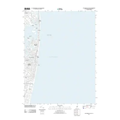
2011 Map of Long Branch East
USGS Topo · Published 2011About this map
The Atlantic Ocean coastline defines this 2011 survey, where the urban density of Long Branch meets the barrier beach communities of the Jersey Shore. The map illustrates a highly developed maritime corridor, stretching from the residential streets of Elberon and West End in the south up through North Long Branch and Monmouth Beach. The narrow strip of land separating Shrewsbury Bay from the open sea is home to the distinct settlements of Galilee, Low Moor, and Sea Bright, highlighting the precarious geography of this coastal stretch. Inland, the suburban character of Rumson is visible, while offshore features like Shrewsbury Rocks and landmarks such as the Marathon Dance Pier emphasize the area's long-standing connection to both commercial and recreational seafaring. The map captures a landscape defined by its grid of coastal avenues and its proximity to the tidal waters of Branchport and its surrounding islands.
Find a feature on this map
115 named features on this map. Tap any name to fly to it.
Don’t see what you’re looking for? This feature index may not catch every label — zoom into the map to look around manually.
Map Details
Editions of this 2011 Long Branch East Map
This is the sole edition of this map. No revisions or reprints were ever made.
Other maps of this area

1888 · Asbury Park
USGS Topo · 1:62,500

1888 · Sandy Hook
USGS Topo · 1:62,500

1893 · Sandy Hook
USGS Topo · 1:62,500

1893 · Asbury Park
USGS Topo · 1:62,500

1901 · Sandy Hook
USGS Topo · 1:62,500

1901 · Asbury Park
USGS Topo · 1:62,500

1902 · Navesink
USGS Topo · 1:125,000

1918 · Sandy Hook
USGS Topo · 1:62,500

1919 · Asbury Park
USGS Topo · 1:62,500

1944 · Newark
USGS Topo · 1:250,000