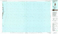
1983 Map of Long Branch
USGS Topo · Published 1984About this map
Sandy Hook defines the northern edge of this coastal survey, home to the Gateway National Recreation Area and the Horseshoe Cove. Moving south along the Atlantic shoreline, the map details the dense corridor of oceanfront communities from Highlands down to Asbury Park. This 1980s landscape shows the intricate waterways of the Navesink River and Shrewsbury River that separate the barrier peninsula from the mainland towns of Rumson and Sea Bright. Small coastal landmarks like Plum Island and Lake Takanassee provide fine-scale geographic detail between the larger settlements of Long Branch and Elberon. The map effectively illustrates the suburban and recreational development of the Monmouth County coast at this point in the late twentieth century.
Find a feature on this map
25 named features on this map. Tap any name to fly to it.
Don’t see what you’re looking for? This feature index may not catch every label — zoom into the map to look around manually.
Map Details
Editions of this 1983 Long Branch Map
This is the sole edition of this map. No revisions or reprints were ever made.
Other maps of this area

1888 · Barnegat
USGS Topo · 1:62,500

1888 · Asbury Park
USGS Topo · 1:62,500

1888 · Sandy Hook
USGS Topo · 1:62,500

1889 · Brooklyn
USGS Topo · 1:62,500

1891 · Brooklyn
USGS Topo · 1:62,500

1893 · Sandy Hook
USGS Topo · 1:62,500

1893 · Asbury Park
USGS Topo · 1:62,500

1893 · Barnegat
USGS Topo · 1:62,500

1897 · Brooklyn
USGS Topo · 1:62,500

1897 · Hempstead
USGS Topo · 1:62,500