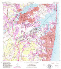
1954 Map of Long Branch
USGS Topo · Published 1986About this map
Fort Monmouth and the U S Naval Weapons Station (Earle) anchor this coastal landscape, reflecting the significant mid-century military presence in Monmouth County. The dense urban corridors of Long Branch and Red Bank are well-defined, showing the intricate street grids and community hubs that shaped the Jersey Shore's northern reaches. Residential growth is evident in settlements like Little Silver, Oceanport, and Fair Haven, while the Garden State Parkway provides a modern transport spine through the western townships of Middletown and Colts Neck.
Find a feature on this map
141 named features on this map. Tap any name to fly to it.
Don’t see what you’re looking for? This feature index may not catch every label — zoom into the map to look around manually.
Map Details
Editions of this 1954 Long Branch Map
5 editions found

Other maps of this area

1888 · Asbury Park
USGS Topo · 1:62,500

1888 · Sandy Hook
USGS Topo · 1:62,500

1893 · Sandy Hook
USGS Topo · 1:62,500

1893 · Asbury Park
USGS Topo · 1:62,500

1901 · Sandy Hook
USGS Topo · 1:62,500

1901 · Asbury Park
USGS Topo · 1:62,500

1902 · Navesink
USGS Topo · 1:125,000

1918 · Sandy Hook
USGS Topo · 1:62,500

1919 · Asbury Park
USGS Topo · 1:62,500

1942 · Farmingdale
USGS Topo · 1:24,000