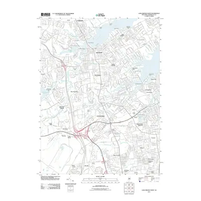
2011 Map of Long Branch West
USGS Topo · Published 2011About this map
Red Bank and Eatontown anchor this detailed study of Monmouth County's coastal interior, where a complex network of waterways defines the suburban and commercial landscape. The map highlights the significant presence of Monmouth University and the historical weight of numerous local burying grounds, including Fairview Cemetery and the Quaker Cemetery. From the winding course of the Navesink River and Swimming River to the smaller estuaries like Little Silver Creek, the area shows a high density of residential development interwoven with major infrastructure like the Eatontown Dam and Monmouth Water Works. This 2011 survey documents a modern era of the Jersey Shore's hinterland, preserving the locations of legacy sites like Cooks Mills and the EAI Landing Strip amidst the evolving suburban sprawl.
Find a feature on this map
77 named features on this map. Tap any name to fly to it.
Don’t see what you’re looking for? This feature index may not catch every label — zoom into the map to look around manually.
Map Details
Editions of this 2011 Long Branch West Map
This is the sole edition of this map. No revisions or reprints were ever made.
Other maps of this area

1888 · Asbury Park
USGS Topo · 1:62,500

1888 · Sandy Hook
USGS Topo · 1:62,500

1893 · Sandy Hook
USGS Topo · 1:62,500

1893 · Asbury Park
USGS Topo · 1:62,500

1901 · Sandy Hook
USGS Topo · 1:62,500

1901 · Asbury Park
USGS Topo · 1:62,500

1902 · Navesink
USGS Topo · 1:125,000

1918 · Sandy Hook
USGS Topo · 1:62,500

1919 · Asbury Park
USGS Topo · 1:62,500

1942 · Farmingdale
USGS Topo · 1:24,000