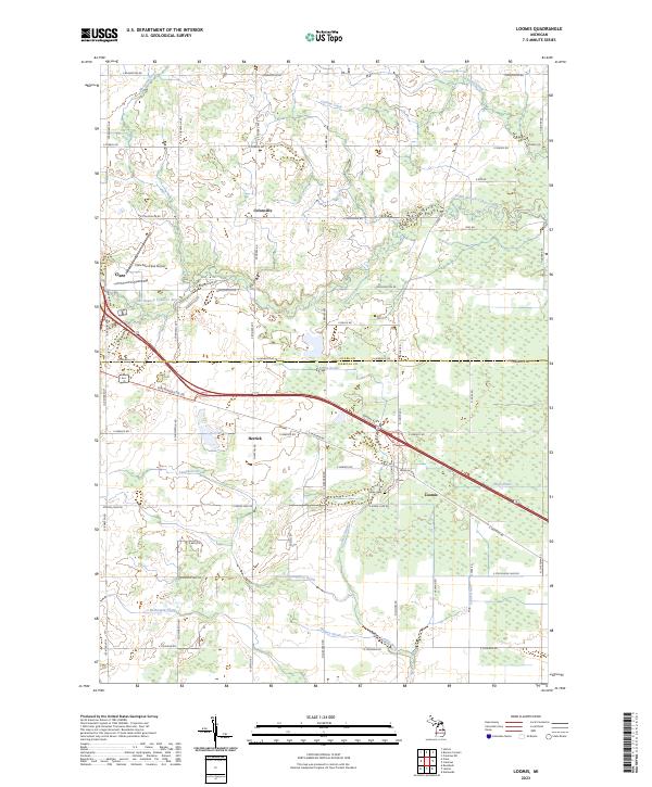
2023 Map of Loomis
USGS Topo · Published 2023About this map
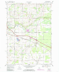
The Clare Co Isabella Co boundary line bisects this central Michigan landscape, where the agricultural plains are defined by an extensive network of drainage channels. The South Branch Tobacco River meanders across the western half, while a complex system of engineered waterways like the Loomis Drain, High Drain, and McDonald Drain manage the low-lying terrain. Small settlements and rural crossroads punctuate the grid, most notably the community of Loomis in the east and Herrick to its west.
Find a feature on this map
55 named features on this map. Tap any name to fly to it.
Don’t see what you’re looking for? This feature index may not catch every label — zoom into the map to look around manually.
Map Details
Editions of this 2023 Loomis Map
This is the sole edition of this map. No revisions or reprints were ever made.