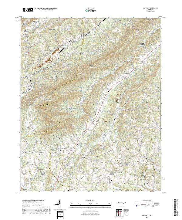
2022 Map of Luttrell
USGS Topo · Published 2022About this map
Clinch Mountain and the parallel Copper Ridge define the topographic character of this Tennessee landscape, where the Clinch River and Holston River shape the surrounding valleys. The map reveals a dense distribution of family burial grounds and small communities such as Lea Springs and Zacharytown. The agricultural and residential settlement pattern is deeply tied to the corridors of Richland Valley and Flat Creek Valley, with several small watercourses like Bullrun Creek and Richland Creek providing the primary drainage for the ridges. Notable landmarks such as Melton Field and Race Track Bluff offer specific points of interest for local researchers. The convergence of multiple county lines, including Union, Grainger, Knox, and Jefferson, highlights the complex political geography of this rural area.
Find a feature on this map
164 named features on this map. Tap any name to fly to it.
Don’t see what you’re looking for? This feature index may not catch every label — zoom into the map to look around manually.
Map Details
Editions of this 2022 Luttrell Map
This is the sole edition of this map. No revisions or reprints were ever made.
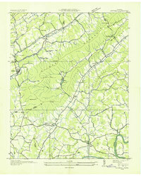
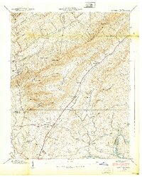
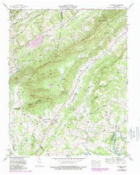
Historical Maps of Perrin Hollow Through Time
4 maps found