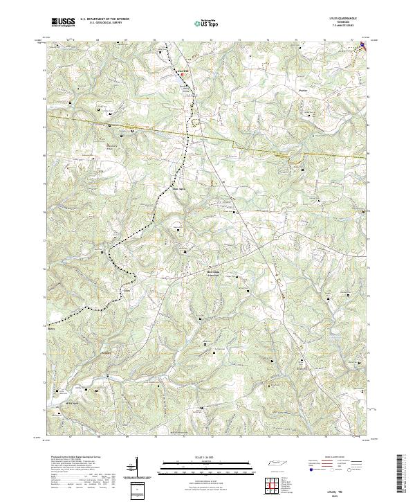
2022 Map of Lyles
USGS Topo · Published 2022About this map
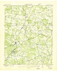
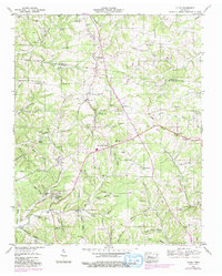
Bon Aqua Springs and the surrounding wooded hollows of Middle Tennessee define this portrait of the Dickson Co and Hickman Co borderlands. The landscape is heavily marked by small family and community burial grounds, including the Vineyard Cem, Lyles Cem, and Potts Cem, which provide essential geographic markers for genealogical research. The settlement of Lyles and the industrial-era community of Wrigley sit south of the spring, connected by a network of drainage-following roads like Old Mill Creek Rd and Primm Springs Rd. Terrain here is characterized by deep incisions such as Baker Hollow and Bradford Hollow, which dictate the placement of local homesteads and historical transit corridors between Iron Hill and Brown Hill.
Find a feature on this map
125 named features on this map. Tap any name to fly to it.
Don’t see what you’re looking for? This feature index may not catch every label — zoom into the map to look around manually.
Map Details
Editions of this 2022 Lyles Map
This is the sole edition of this map. No revisions or reprints were ever made.