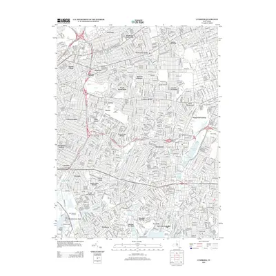
2013 Map of Lynbrook
USGS Topo · Published 2013About this map
Montefiore Cem and Beth David Cem occupy large tracts of the landscape on this Long Island survey, reflecting the area's significance for regional cemeteries. The dense suburban fabric of western Nassau County and eastern Queens is established by the mid-2010s, with a continuous network of residential streets connecting established communities like New Hyde Park, Malverne, and Elmont. The map records a complex hydrological system where Valley Stream flows toward the south shore through a series of managed basins including Smith Pond and Hempstead Lake. Educational institutions such as Adelphi Univ and Molloy College appear alongside recreational spaces like the North Woodmere Golf Course. Major transit corridors, including the Southern State Pkwy and Cross Island Pkwy N, bisect these neighborhoods, illustrating the post-war transportation infrastructure that defines the modern settlement pattern of the Queens-Nassau border.
Find a feature on this map
67 named features on this map. Tap any name to fly to it.
Don’t see what you’re looking for? This feature index may not catch every label — zoom into the map to look around manually.
Map Details
Editions of this 2013 Lynbrook Map
This is the sole edition of this map. No revisions or reprints were ever made.
Other maps of this area

1889 · Brooklyn
USGS Topo · 1:62,500

1891 · Brooklyn
USGS Topo · 1:62,500

1891 · Harlem
USGS Topo · 1:62,500

1897 · Harlem
USGS Topo · 1:62,500

1897 · Brooklyn
USGS Topo · 1:62,500

1897 · Hempstead
USGS Topo · 1:62,500

1897 · Oyster Bay
USGS Topo · 1:62,500

1898 · Harlem
USGS Topo · 1:62,500

1898 · Hempstead
USGS Topo · 1:62,500

1898 · Brooklyn
USGS Topo · 1:62,500