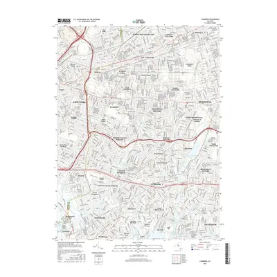
2016 Map of Lynbrook
USGS Topo · Published 2016About this map
The boundary between Queens and Nassau counties defines this densely developed portion of Long Island during the mid-2010s. This survey illustrates a complex mosaic of suburban residential grids and commercial hubs, including the Green Acres Mall and the campuses of Adelphi University and Molloy College. A major concentration of cemeteries, such as Beth David Cem, Montefiore Cem, and Maimonides-Elmont Cem, occupies significant acreage between Elmont and Springfield Gardens.
Find a feature on this map
94 named features on this map. Tap any name to fly to it.
Don’t see what you’re looking for? This feature index may not catch every label — zoom into the map to look around manually.
Map Details
Editions of this 2016 Lynbrook Map
This is the sole edition of this map. No revisions or reprints were ever made.
Other maps of this area

1889 · Brooklyn
USGS Topo · 1:62,500

1891 · Brooklyn
USGS Topo · 1:62,500

1891 · Harlem
USGS Topo · 1:62,500

1897 · Harlem
USGS Topo · 1:62,500

1897 · Brooklyn
USGS Topo · 1:62,500

1897 · Hempstead
USGS Topo · 1:62,500

1897 · Oyster Bay
USGS Topo · 1:62,500

1898 · Harlem
USGS Topo · 1:62,500

1898 · Hempstead
USGS Topo · 1:62,500

1898 · Brooklyn
USGS Topo · 1:62,500