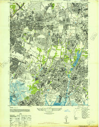
1947 Map of Lynbrook
USGS Topo · Published 1947About this map
Nassau County and the Borough of Queens meet in this post-war landscape defined by rapid suburban densification and grand institutional grounds. The Long Island Railroad network, including the West Hempstead Branch and Montauk Division, anchors the transportation corridor that fueled the growth of Garden City, Floral Park, and Valley Stream. Large-scale land use is dominated by the sprawling Belmont Park Race Track and the Creedmoor Division Brooklyn State Hospital, while the presence of the Curtiss Wright Airport highlights the era's aviation infrastructure before modern commercial expansion.
Find a feature on this map
101 named features on this map. Tap any name to fly to it.
Don’t see what you’re looking for? This feature index may not catch every label — zoom into the map to look around manually.
Map Details
Editions of this 1947 Lynbrook Map
This is the sole edition of this map. No revisions or reprints were ever made.
Other maps of this area

1889 · Brooklyn
USGS Topo · 1:62,500

1891 · Brooklyn
USGS Topo · 1:62,500

1891 · Harlem
USGS Topo · 1:62,500

1897 · Harlem
USGS Topo · 1:62,500

1897 · Brooklyn
USGS Topo · 1:62,500

1897 · Hempstead
USGS Topo · 1:62,500

1897 · Oyster Bay
USGS Topo · 1:62,500

1898 · Harlem
USGS Topo · 1:62,500

1898 · Hempstead
USGS Topo · 1:62,500

1898 · Brooklyn
USGS Topo · 1:62,500