2023 Map of Lyons
USGS Topo · Published 2023About this map
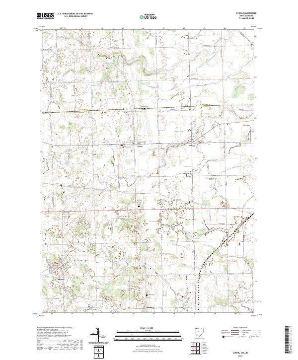
Lyons and Seward anchor this borderland survey, where the Michigan-Ohio state line and the boundary between Lenawee and Fulton counties bisect a landscape defined by small-scale agriculture and a network of named drainages. The terrain is patterned by a strictly rectangular road grid, including W Mulberry Rd and Us Rte 20, which navigate around the winding courses of Bear Creek and Bad Creek. The survey identifies several small rural settlements and hubs like Advance and Winameg, reflecting the area's long-standing character as a farming region.
Find a feature on this map
41 named features on this map. Tap any name to fly to it.
Don’t see what you’re looking for? This feature index may not catch every label — zoom into the map to look around manually.
Map Details
Editions of this 2023 Lyons Map
This is the sole edition of this map. No revisions or reprints were ever made.