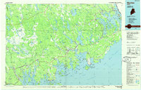
1985 Map of Machias
USGS Topo · Published 1986About this map
The Maine Central railroad corridor and a complex network of coastal rivers define the Downeast landscape of Washington County in the mid-1980s. From the shire town of Machias, the map traces a jagged shoreline punctuated by Machias Bay and Englishman Bay, where centuries-old fishing and maritime traditions persist in settlements like Jonesport, Beals, and Machiasport. The transition from the rugged Atlantic coast to the inland blueberry barrens and timberlands is marked by expansive features such as The Heath and The Barrens.
Find a feature on this map
223 named features on this map. Tap any name to fly to it.
Don’t see what you’re looking for? This feature index may not catch every label — zoom into the map to look around manually.
Map Details
Editions of this 1985 Machias Map
This is the sole edition of this map. No revisions or reprints were ever made.
Other maps of this area

1902 · Cherryfield
USGS Topo · 1:62,500

1904 · Cherryfield
USGS Topo · 1:62,500

1904 · Bar Harbor
USGS Topo · 1:62,500

1904 · Petit Manan
USGS Topo · 1:62,500

1907 · Eastport
USGS Topo · 1:48,000

1908 · Eastport
USGS Topo · 1:62,500

1917 · Cutler
USGS Topo · 1:62,500

1918 · Machias
USGS Topo · 1:62,500

1918 · Cutler
USGS Topo · 1:62,500

1921 · Great Wass Island
USGS Topo · 1:62,500