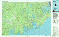
1994 Map of Machias
USGS Topo · Published 1994About this map
The coastal landscape of Washington County meets the Grand Manan Channel in this detailed study of Maine's Downeast shoreline. Centered on Machias, the map reveals a complex geography of river estuaries and deep bays, including Machias Bay and the sprawling Cobscook Bay. Significant federal and state landholdings define the region, from the Moosehorn National Wildlife Refuge to the specialized installations at the Columbia Falls Air Force Station and the U.S. Naval Radio Station near Cutler. The inland terrain transitions from the marshy expanses of The Barrens to the Round Lake Hills, drained by the Narraguagus River and East Machias River. This 1994 edition, revised from earlier surveys, preserves the footprint of traditional fishing and shipping hubs like Jonesport, Machiasport, and Lubec before late-century development altered the character of these maritime communities.
Find a feature on this map
100 named features on this map. Tap any name to fly to it.
Don’t see what you’re looking for? This feature index may not catch every label — zoom into the map to look around manually.
Map Details
Editions of this 1994 Machias Map
This is the sole edition of this map. No revisions or reprints were ever made.
Other maps of this area

1902 · Cherryfield
USGS Topo · 1:62,500

1904 · Cherryfield
USGS Topo · 1:62,500

1904 · Bar Harbor
USGS Topo · 1:62,500

1904 · Petit Manan
USGS Topo · 1:62,500

1907 · Eastport
USGS Topo · 1:48,000

1908 · Eastport
USGS Topo · 1:62,500

1917 · Cutler
USGS Topo · 1:62,500

1918 · Machias
USGS Topo · 1:62,500

1918 · Cutler
USGS Topo · 1:62,500

1921 · Great Wass Island
USGS Topo · 1:62,500